Google maps used for news

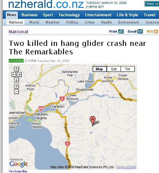
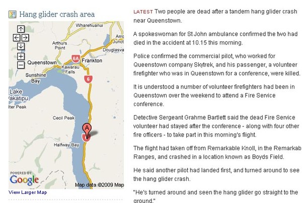
Google maps are now used by both NZ Herald and Stuff but are they helping to explain the story or just eye candy? Both have used maps for today's hang glider crash but NZ Herald shows a different location than Stuff.
Despite having a photo of the crash, the map on Stuff shows the same location as a Google map search for Kingston Rd, while the Herald has the location a further 10km north and some what more believably in the hills. Therefore I suspect Stuff is guilty of lazy journalism on this one.
It's great to see both sites expanding their use of multimedia though and this follows on from Stuff's re-launch last week which Vaughan Rowsell does a good job analysing.
I too was wondering what the point of a customisable homepage is when you have to scroll down two screens to get to it. At least they offer RSS feeds as I have already customised my news homepage and it can be found at Google Reader, and lately more often at Twitter.
It sounds like there is more to come from Stuff though with Southland Time's Fred Tullet explaining on last Sunday's Media Watch that by the end of the year his reporters would be filming video. Jim Tucker has more on this, but this all seems to be jumping the gun and maybe someone could kindly teach Stuff how to put links into their stories.