Road closures and diversions affecting Wellington campus
As part of the development of the National War Memorial Park and Buckle St under-pass, road closures and diversions will affect staff, student and visitor access to the Wellington campus for the next 18 months.
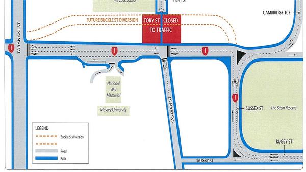
Stage one of the development, from December 27 until late January, will see Tory St closed between Mt Cook School and Buckle St to all traffic other than cyclists and pedestrians.
Students staff and visitors wanting to get to the Tasman St entrances by vehicle will need to travel either around the Basin Reserve to Rugby St or around the campus via Wallace St and John St. New signage will be installed to direct traffic.
Stage two of the project will begin in late January and will include additional road closures and diversions. More detailed information about these changes will be made available in the New Year once the timing and details have been confirmed.
It is recommended that all staff, students and visitors allow an extra 5-10 minutes to their schedules to accommodate any traffic delays.