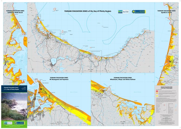
Tsunami inundation zones for Tauranga and the Bay of Plenty coastline

Tsunami Map Credit:
Tauranga City Council
A newly developed map showing tsunami inundation zones for Tauranga and the Bay of Plenty coastline has been released by the Bay of Plenty Civil Defence Emergency Management Group (CDEMG) as a tool to help coastal residents improve their tsunami preparedness planning.
The map shows the distance a tsunami surge would travel inland based on worst case scenario planning of tsunami surge heights.
The map can be viewed on the Bay of Plenty Civil Defence Emergency Management Group website www.bopcivildefence.govt.nz.